

As the name implies, wetlands are… wet.
They may have water visible at the surface, water right below the ground surface, or water much further below the ground surface- referred to as the “water table”, i.e. a threshold that measures where the soil becomes fully saturated- there is only water and no air in the soil.
Hydrology is the study of the properties, distribution and circulation of aboveground, belowground, and atmospheric water.
Wetland hydrology monitoring

cross-sectional schematic showing a water table below a wetland at both high and low levels.
It may not be obvious to the untrained eye that the water table is close to the surface, or an area that looks dry in the fall was an enormous pool of water in the spring. In some wetlands, the water table will stay relatively stable and in others it may fluctuate up and down throughout the year. Increasing our understanding of wetland hydrology will help us conserve and improve how we work and play in and around wetlands.
Monitoring the water table is part of the toolbox (along with soil temperature, vegetation communities, rainfall, etc.) for understanding the controls on wetland processes. For example, a wetland that has a lower than typical water table position may exhibit stressed out vegetation communities until the water table returns to that of a typical year. If the water table continues to remain lower, you may expect to see a shift in vegetation communities from those that need a higher water table (i.e. moss) to those that prefer a lower water table (i.e. shrubs). Or reversely a swamp wetland that has large fluctuations in the water table position, which allows trees to survive because of the drier conditions, may exhibit increased tree mortality if water tables remain high throughout multiple years. Not all wetlands are impacted the same by changes in water table position, and shifts in vegetation communities impact habitat for wildlife, carbon sequestration, water storage, etc.
The hydrology monitoring pilot project was implemented fall 2020 to support the Wetland Centre project that Ducks Unlimited Canada (DUC) and the Evergreen Learning and Innovation Society (ELIS) are leading at Evergreen Park in the County of Grande Prairie, Alberta. DUC in partnership with Dr. Scott Ketcheson at Athabasca University are working towards improving the understanding of boreal wetland hydrology at the Boreal Wetland Centre. This pilot project was supported with funding from Pembina Pipeline Corporation.
The water line (white arrow) on this spruce tree is a quick visual way to monitor the hydrology in this swamp- it shows that previously the site had deeper water i.e., more pooling water above the ground surface. In other words, it would have been much more wet walking through here earlier in the season.

Field activities
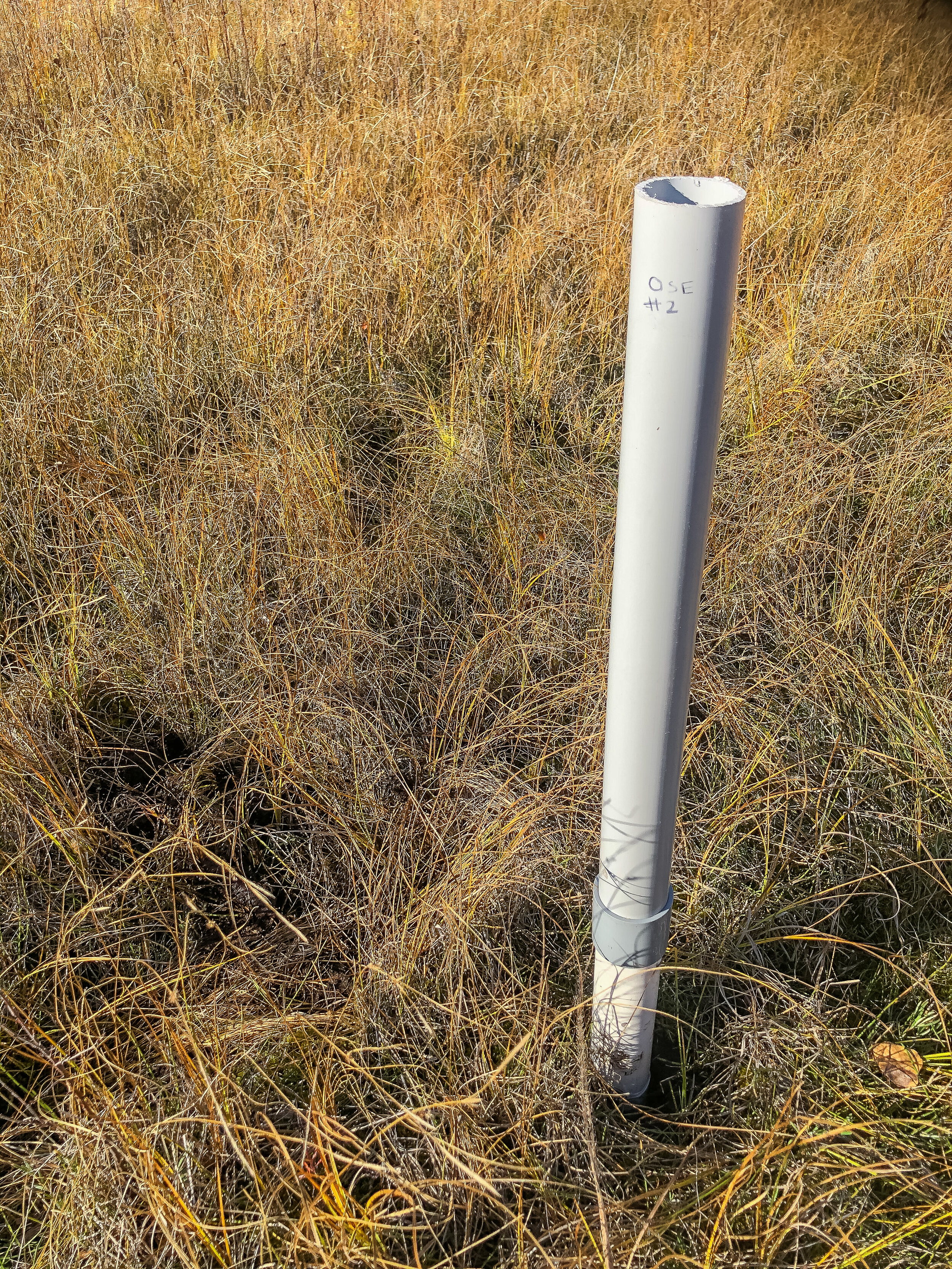
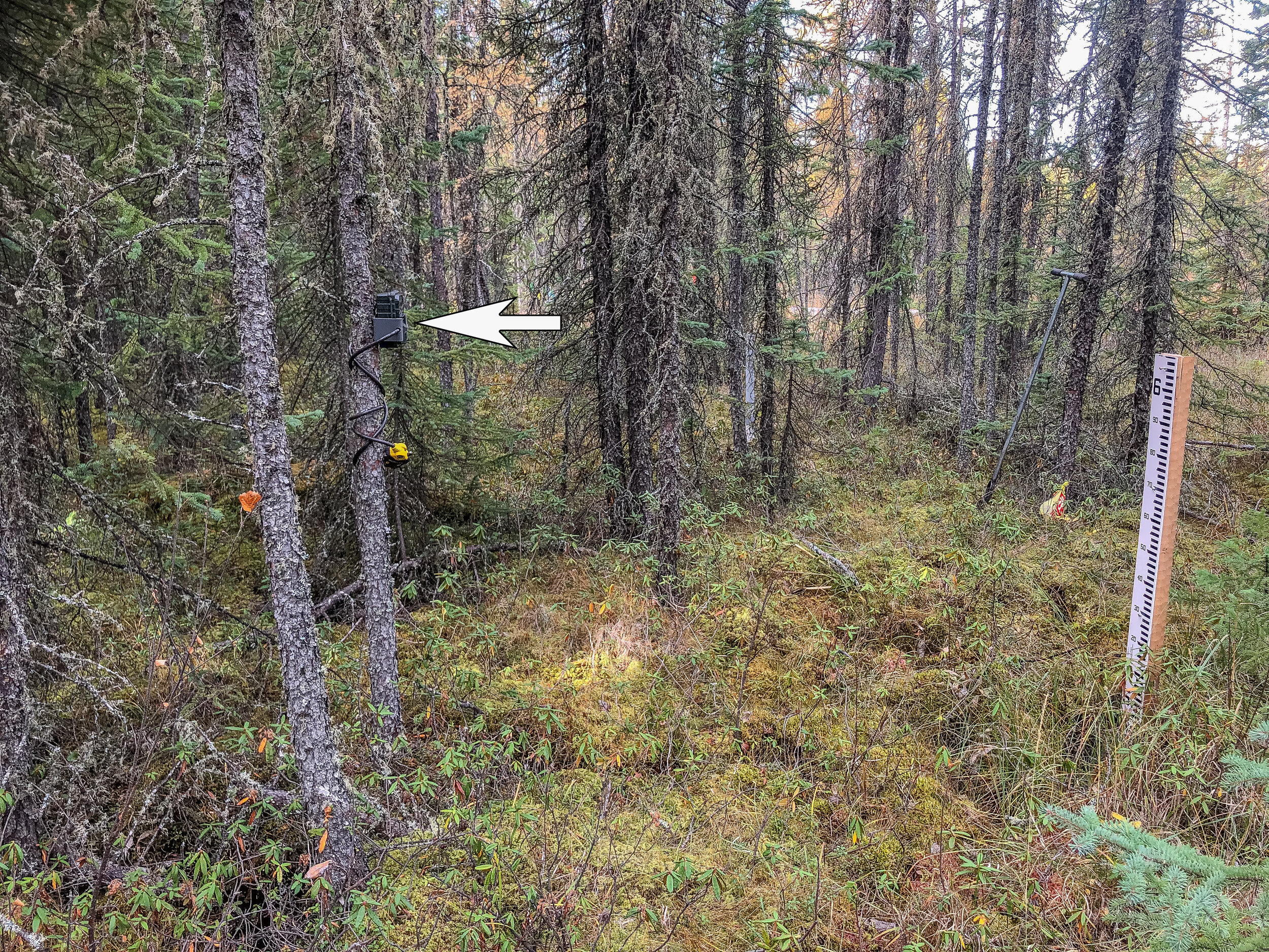
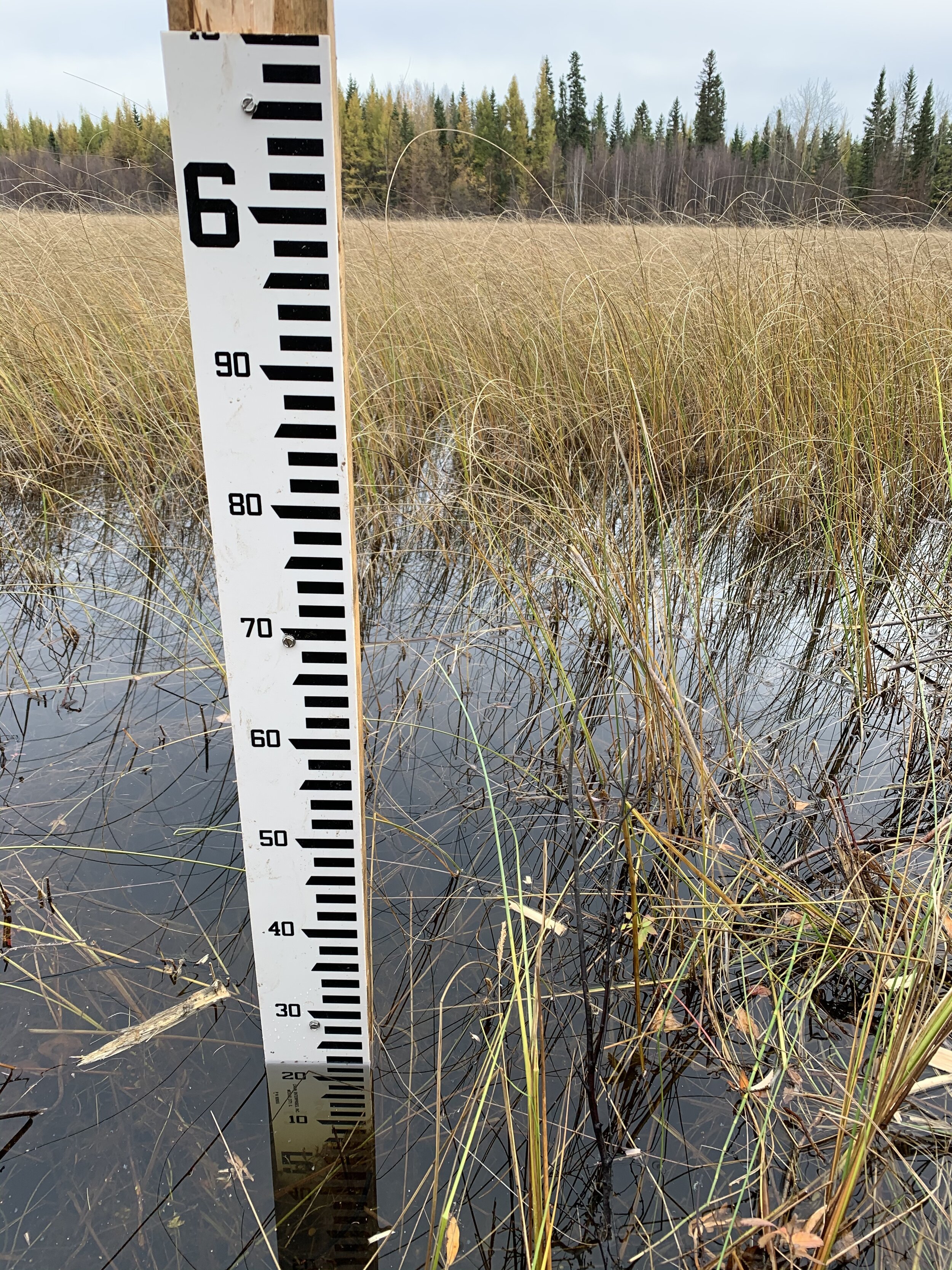
In October 2020 Catherine Brown, DUC Boreal staff, and Dr. Scott Ketcheson from Athabasca University installed 16 water level monitoring wells, four trails cameras (lent to DUC by the Alberta Biodiversity Monitoring Institute) and four staff gauges at Evergreen Park as part of the Wetland Centre Project. The purpose of the monitoring wells is to measure changes in water level positions at each wetland type throughout the year. The trail cameras are pointed at the staff gauges to take three pictures daily which will be used to measure snow accumulation and rate of melt at each of the sites. Snow is an important water input into wetlands and understanding how snow inputs varies in different years will improve our understanding of wetland functions at the site.
Below are the 2022 and 2023 Hydrology Reports. These are based on the data collected by staff and volunteers at the monitoring wells.
2022 Hydrology Monitoring Project Report:
2023 Hydrology Monitoring Project Report:
please contact Kailee Goertzen at k_goertzen@ducks.ca if you are interested in learning more about the hydrology monitoring pilot project.


