Wetland Centre End of Year Recap

Happy November everyone! 

With the weather cooling down, the Boreal Wetland Centre is wrapping up its onsite activities. We’ve had some great events over the summer and fall including:  

-Air and Watershed Stewardship Division tour (July 25th): The Air and Watershed Stewardship Division from the Government of Alberta (Environment and Protected Areas) toured the Boreal Wetland Centre discussing wetlands and wetland conservation.  

-Junior Forest Rangers maintenance day (Aug 9th): The Junior Forest Ranger team came out to the Boreal Wetland Centre to help with site maintenance. This included a clean-up the site, brush cutting of the trails, and removal of noxious weeds.  

The Junior Forest Rangers get ready to clean the site

-DUC HAM tour (Aug 16th): The DUC Habitat Asset Management team toured the Boreal Wetland Centre during their two-day team meetings. While touring the site they learned how to identify, classify, and delineate boreal wetlands.  

-Inside Education (Sept 11th-15th): Inside Education delivered educational programing at the Boreal Wetland Centre utilizing the habitat and on-site installations to provide real world examples for local school curriculum. 

-National Forest Week tour (Sept 19th): In recognition of National Forest Week, a week devoted to raising awareness and educating about vital forest habitat, DUC hosted a tour with local professionals from Canfor and Weyerhaeuser teaching attendees about the value of forests, sustainable forest management, silviculture, growth and yield, and the connection between forests and wetlands. 

Weyerhaeuser explains forest growth to attendees

-Homeschool Tea-time Part 2 (Sept 20th): In the summer, the homeschool community took part in a unique experiment, burying tea bags around the Boreal Wetland Centre to test decomposition. The group returned to the Boreal Wetland Centre in September to dig up and weigh the tea bags and analyze our results! 

DUC discusses experiment results with homeschool children

-Boreal Wetland Centre Site Improvements (July-September): The Boreal Wetland Centre received an update in 2023 with several inactive demonstrations being removed. The existing trail was replaced with gravel for easier access and the entrance to the Boreal Wetland Centre was expanded. In addition, entryway posts, a sheltered trailhead sign, several trash cans, a pair of benches, and an outdoor classroom were all installed on site. 

-New Demo Installation: Smash & Sons Contracting donated a new demonstration to the Boreal Wetland Centre. A pipeline topsoil cutter was refurbished and placed near the entrance with signage soon to come! 

Pipeline topsoil cutter

-Wetland Centre of Excellence Launch event (Sept 28th): Back in early 2023, Peace Wapiti Academy joined the Wetland Centre of Excellence program (a national student led initiative of wetland projects, mentorship and community outreach). In September, Peace Wapiti Academy and DUC celebrated the start of the program with roughly 100 students, teachers, County of Grande Prairie officials, and media representatives touring the trails and learning more about the program. 

Peace Wapiti Academy Students celebrate the launch of the Wetland Centre of Excellence

-Inside Education (Oct 2nd-6th): Delivered educational programing at the Boreal Wetland Centre utilizing the habitat and on-site installations to provide real world examples of topics for local schools. Alliance Pipeline also came out on October 3rd to tour the new amenities and participate in Inside Education’s programming.  

-Hammerhead Energy Corduroy Road Restoration Monitoring (October 5th): After a portion of the corduroy road at the Boreal Wetland Centre was restored earlier in the year, monitoring plots were installed on the restored area to collect data and monitor whether restoration was successful.  

Corduroy Road Restoration Monitoring plots

-Wetland Centre Funders Group tour (Oct 24th) and Wetland Centre Advisory Group tour (Nov 2nd): The Boreal Wetland Centre funders, advisory group, and members of Evergreen Park all came out to the Boreal Wetland Centre to tour the site, view the upgrades, and discuss future opportunities for the site.  

During the season our staff and volunteers also collected valuable data in the form of wetland hydrology well levels and phenology board photos. Thank you to everyone who collected datapoints for us this year! 

And still to come, the installation of a gateway entrance sign is well underway at the Boreal Wetland Centre. Men’s Shed is collaborating with DUC to create an entrance to be proud of! 

Men’s Shed starts the trailhead sign

Though our programing slows down in the winter, the Boreal Wetland Centre will be open for anyone to tour. The trails aren’t cleared of snow, but the main trail is often packed down by foot traffic. In addition, if you want to tour the side trails, feel free to bring your snowshoes! 

Wetland Centre Construction Update!

Happy August!

The Wetland Centre is getting an update in August and September! A week-long construction project was scheduled to start July 24 to 28, 2023, but due to the rain, was moved to the first week of August. The first phase of construction took place between July 31st and August 4th. This phase involved removing several inactive demos and building the pad for our future outdoor classroom!

But most excitingly, this included the upgrade of the Wetland Centre’s main trail! The existing path was replaced with geotextile fabric and gravel for easier access to the heart of the Centre. The front entrance was also expanded to make way for some new amenities!

The work was completed by Smash & Sons Contracting Ltd, who have the Wetland Centre looking better than ever! Stay tuned for more upgrades being completed at the Wetland Centre in Fall 2023, including the installation of garbage cans, benches, trailhead signage, an entrance gateway, and an outdoor classroom!

Summer 2023 Bioblitz at the Wetland Centre

From June 19th to25th, 2023, Ducks Unlimited Canada hosted the third annual Bioblitz at the Wetland Centre using the iNaturalist app! A Bioblitz is a great way for nature enthusiasts of all ages, experience levels to familiarize themselves with the biodiversity in an area. Each species identified in the specified time period contributes to an improved understanding of the diverse communities present at the Wetland Centre. Stay tuned and check the project page for future bioblitzes and other citizen science events.


Over this week, the Wetland Centre was teeming with life; Visitors collected 23 observations, documenting 15 plant and mammal species at the site. The most common observations can be found below.

This year, iNaturalist users e_caldwell, afoizy2, j_pinzon and shrubbymarsh all contributed observations. Thanks to everyone who participated in this citizen science event - every contribution is valuable!


One of the wetland species captured was an important wetland species. Also known as buck-bean, This species is typically found in fens and swamps and is a strong indicator of a wetland habitat.

Bogbean (Menyanthes trifoliata) CAPTURED 07/22/23 BY Emilie.


Missed the Bioblitz but want to contribute your observations? Join our project here and search for the location ‘The Wetland Centre at Evergreen Park’ when uploading your photos/audio recordings. Stay tuned and check the project page for future Bioblitzes and other citizen science events!


Map of all the observations collected during the Bioblitz

Wetland Center Event Update

Happy June everyone!

The Wetland Center has had some great early season activities including:

-The Indigenous Wetland Pilot Project (April 10-14, 2023): DUC visited various Indigenous groups to learn how DUC can braid Indigenous knowledge into the Wetland Centre.

-Danger Tree Assessment (April 21, 2023): Alberta Wildfire in coordination with Weyerhaeuser generously removed all trees in danger of falling within the bounds of the Wetland Centre ensuring the safety of all trail participants.

-DUC at Earth Day Event (April 22, 2023): DUC attended the Earth Day celebration hosted by the City of Grande Prairie and County of Grande Prairie No. 1 educating the public about wetlands role in the environment and the Wetland Center at Evergreen Park.

-Peace Wapiti Academy Project Day (May 4, 2023): Students from Peace Wapiti Academy came out to the Wetland Center to help clear new trails for the upcoming Walk through the Forest event as part of the Wetland Centre of Excellence program at the high school.

-Construction of the Hammerhead Energy Corduroy Road Extension: Ironwood Mats, in association with Hammerhead, used the wood of trees taken down during the Danger Tree Assessment to build a boardwalk across a wetland connecting the edge of the corduroy road demonstration and the existing trail system. In addition, Northlink Supply spread mulch and seed on the slopes of the corduroy road demonstration to minimize erosion of the road from precipitation.

Citizen Science Visits: Volunteer data collection of the 29 water wells at the Wetland Centre continued in May 2023 (new volunteers always welcome!). In addition, various groups came as part of data collection efforts including for the May Plant Count (May 27, 2023 – Alberta Native Plant Council) and a birding tour (June 3, 2023 – Peace Parkland Naturalist Club).

-Wetland Assessment Knowledge Exchange (June 6, 2023): Professionals in the environmental field and wetland enthusiasts gathered to learn about vegetation and soil identification and wetland classification while sharing industry insights on wetland conservation. This event was facilitated by DUC.

K-12 Education: Although delayed by wildfire/smoke risk, K-12 programming delivered at the Wetland Centre by Inside Education and the Mighty Peace Watershed Alliance officially kicked off in June with multiple classes visiting the Wetland Centre for curriculum-tied tours.

-Bioblitz (June 19-25, 2023): A weeklong event promoting iNaturalist and citizen science happened at the Wetland Centre offering a variety of events including: iNaturalist introductions, a wetland stewardship presentation as part of NAIT’s Centre for Boreal Research speaker series, a tea bag science experiment for the homeschool community, a tour of the SEEDS research demonstration (Seed Enhanced Ecological Delivery System) with Natural Resources Canada staff member Richard Krygier, and a plant walk led by DUC.

With the unexpected complications from the recent wildfires, several of our anticipated May events were cancelled or rescheduled. This included Walk Through the Forest, hosted by The Grande Prairie and Area Environmental Sciences Educational Society (GPESES), and was rescheduled for early May of 2024. Also cancelled was our volunteer maintenance day which would have seen Weyerhaeuser and Canfor summer students and staff assisting with site maintenance and clean-up. Other cancelled events include the Inside Education programming which had been originally scheduled for mid-May and the Country of Grande Prairie High School tours (tentatively rescheduled for Spring 2024).

Regardless, the Wetland Center is still aiming to make the most of the summer weather. We’ve still got events coming up such as the Junior Forest Ranger Maintenance Day and upcoming infrastructure improvements at the Wetland Centre (i.e., trail upgrades, garbage cans, etc.)! Keep an eye on the event schedule and stay tuned!

Digging Discovery: How Organic Material Accumulation is used to Classify Wetlands at the Wetland Centre

What makes a wetland a wetland? How can you tell where one wetland class ends, and another begins? The material under your feet can help you discover the answers to these questions! To better understand the classes of wetlands present at the Wetland Centre at Evergreen Park and to refine the original wetland boundary mapping developed in 2016, Ducks Unlimited Canada (DUC) collected peat depth and vegetation data at sampling sites across the Wetland Centre in July 2022.

Rick Murray (DUC Conservation Programs Specialist) led the assessment and was supported by the Grande Prairie Junior Forest Ranger Team and DUC staff member, Madalyn Barnfield.

Using a hand-auger with multiple extensions (that reach depths of 3.2 m) and our trusty wetland classification guidebook, the team collected soil and vegetation data from 29 sites in 2022, to add to the 27 sites already done from 2019 to 2021.

Peat depths locations recorded at the Wetland Centre from 2019 to 2022.

Of the sites completed in 2022, 19 were “simple assessments” where we recorded organic material depth and a general observation of plant species at the site. We also completed ten “detailed assessments” where we recorded : organic material depth, decomposition rate (i.e., Von Post rating), texture of the mineral underlying the organic material (e.g. sand, silt, clay, etc.), indicators of water influencing the soils (e.g., mottling, gleying [see Photos below]), type of plants, plant cover height, and surface or below ground water depths.

So how exactly can we use this information to tell if we’re in a wetland? There are a few key indicators that can be spotted when soils are wet for long enough. These indicators include the accumulation of organic material (deep peat!), soil mottling, and gleying. If you have any of these soil indicators, it’s time to get your guidebooks out to take a closer look!

Prominent mottling in Soil (Orange colour splotches; left Photo), gleying in soil (dull dark gray, bluish tinge colour; Middle and Right PHotos)..

An accumulation of organic material is often a sign that you are in a wetland. In addition, the depth of organic material can help determine whether an area is a peatland (bogs and fens; >40 cm) or mineral wetland (swamps, marshes, shallow open waters; <40 cm).

Various fen and swamp soil samples laid out to show the different layers of organic material (darker colour) prior to reaching the underlying clay (Note: The top of each photo represents the ground surface).

Let’s take a look at what we found at the Wetland Centre to see if our assumptions match our results:

  • Five sites were Upland (zero/minimal organic material accumulation, no mottling or gleying)

  • Nine sites were Wooded Coniferous Swamp (ranged between 20 to 150 cm organic material accumulation with a Von Post of 5 to 7)

  • Three sites were Shrubby Fen (ranged between 175 to 265 cm organic material accumulation; no Von Post recorded)

  • Twelve sites were Wooded Coniferous Fen (ranged between 75 to 245 cm organic material accumulation with a Von Post of 4 to 5)

organic material depths (cm) recorded at the Wetland centre in 2022

“But wait!? Some of these swamps have >40 cm of organic material; shouldn’t they be classified as fens?” You’re right, but relying on organic material depth alone can be tricky when determining the wetland class. Another indicator to consider when determining whether an area is a peatland or mineral wetland is how decomposed the organic material is. Weakly decomposed organic material is typically associated with bogs and fens while highly decomposed organic material is typically associated with swamps, marshes and shallow open waters.

Examples of weakly decomposed (left; von post 3) and well decomposed (right; von post 6/7) organic Material samples

So, what happens when your depth says peatland (fen) and your state of decomposition says mineral wetland (swamp)? The answer comes down to a judgement call. In this case, although four of the swamp classified sites at the Wetland Centre had >40 cm of organic material accumulation (65, 85, 125 and 150 cm), a closer look at the higher degree of decomposition of the material (Von Post as high as 7) along with a lack of peatland plant species pushed our team to classify these sites as swamps rather than fens.

Exploring the soil in wetlands can be very helpful in determining the wetland class, but it is always best to view soil results alongside other wetland indicators like vegetation. What can be said is that it’s never a dull day in swamp town!

A Wetland Centre for Everyone

Reposted from the original article on the DUC National Boreal Program website written by Chantelle Abma.

On Wednesday October 4th 2022, crowds gathered just outside of Grande Prairie Alberta to learn about the wonderful world of wetlands in their own backyard at the Wetland Centre at Evergreen Park’s first ever Open House. Ducks Unlimited Canada’s National Boreal Program, who manages the site, planned this day to create a way for people from all backgrounds to spend time in a local wetland, learning the characteristics of swamps, fens, bogs, and marshes, as well as walking alongside Indigenous Elder Barbara Goodswimmer from Sturgeon Lake Cree Nation learning the value of plants and their histories, immersing themselves in demonstrations displaying the different ways that industry can operate sustainably on the landscape, learning about community science, and offering feedback on their hopes for the future of the site.


Elder Barbara Goodswimmer from Sturgeon Lake Cree Nation leads an interpretive walk highlighting the functional properties of local vegetation.


Visitors to the open house were treated to delicious foods from local restaurants provided by Northlink Supply, one of many site sponsors, and hands-on displays with guest speakers from organizations like Junior Forest Rangers, Inside Education, County of Grande Prairie #1, Alberta Native Plant Council and Natural Resources Canada. Participants had the chance to win prizes through scavenger hunts, and get their hands dirty with peat sampling and other tour activities.


Ducks Unlimited Canada’s Rick Murray shows local students a peat core sample on a guided tour of the Wetland Centre.


“It was such a valuable experience” said Rick Murray, Conservation Programs Specialist for DUC’s Boreal Program, the staff member who oversees the site. “This event was for everyone, we wanted folks from industry to be able to see that we can help display best practices for their operations, we wanted families to see that this place is accessible to them and their children, we wanted Indigenous peoples to feel welcome in this space and know we are listening, and we wanted local government to know that this gem is just outside our door and understand the knowledge and value that it offers. This event achieved all that and more.”

Jaime Pinzon from Natural Resources Canada (in upper right) discusses peatland restoration on a site tour at the Wetland Centre Open House

In addition to displaying the potential for the site to industry, Indigenous groups, the general public, and local government, the event also highlighted the site’s potential (and already occurring) contributions to the scientific and academic communities. Guest speakers highlighted the current monitoring that is happening at the site, and underscored the value of community-based citizen science, which invites everyone to participate in the collection of data and learning in an easy and accessible way by counting birds and plant species, taking photographs, checking measurements and logging the data on their smartphones.

Opening remarks delivered by Kevin Smith, National Manager of Boreal Programs for Ducks Unlimited Canada (far right) at the Wetland Centre Open House

Organizers of the event collected feedback from visitors after they experienced all that the site had to offer, and will now reflect on that feedback, building a plan for the future of the site with those recommendations in mind.

If you would like to learn more about the site or offer comments, please check out borealwetlandcentre.com


A crowd on a guided tour at the Wetland Centre Open House in Grande Prairie


Loquiz Wetland Tour at the Wetland Centre

The Wetland Centre at Evergreen Park is home to Loquiz! Developed by the County of Grande Prairie No. 1, this app provides a fun and interactive way to navigate the Wetland Centre while competing against other teams to see who is the master of wetland knowledge!

Using your smart phone or tablet with the Loquiz app, you will be prompted to answer various questions about wetlands submitted by wetland experts who live and work in the Peace Region. This includes specialists from the County of Grande Prairie No. 1, Ducks Unlimited Canada, Matrix Solutions Inc., the Alberta Riparian Habitat Management Society (Cows and Fish), the Alberta Conservation Association, and the Mighty Peace Watershed Alliance.

The Loquiz app is perfect for junior high and high school classes, but all groups who are interested are encouraged to reach out for more information!

If are interested in participating, please reach out to Jill Henry (jhenry@countygp.ab.ca) and Kate Winterford (kwinterford@countygp.ab.ca) for more information and to book a timeslot.

Summer 2022 Bioblitz at the Wetland Centre

From June 14th-19th, 2022, Ducks Unlimited Canada hosted the second ever Bioblitz at the Wetland Centre using the app iNaturalist. Over this 5 day period, the Wetland Centre was teeming with life; Visitors collected 158 observations, documenting 85 species of plants, fungi, amphibians, birds, and mammals at the site. The most common observations can be found below.

Stats created by iNaturalist.

This year, iNaturalist user @jcarisalyn achieved the most observations with 46, while @j_pinzon collected the most species (35). Thanks to everyone who participated in this citizen science event - every contribution is valuable.

Missed the Bioblitz but want to contribute your observations? Join our project here and search for the location ‘The Wetland Centre at Evergreen Park’ when uploading your photos/audio recordings.

The Wetland Centre at Evergreen Park boundary with the locations of species found during the Summer bioblitz.

A bioblitz is a great way for nature enthusiasts of all age, skill, and interest levels to familiarize themselves with the biodiversity in an area. Each species identified in the specified time period contributes to an improved understanding of the diverse communities present at the Wetland Centre. Stay tuned and check the project page for future bioblitzes and other citizen science events.

Transition to iNaturalist and Save the Date!

In March 2022, the Alberta Biodiversity Monitoring Institute announced bittersweet news that the Naturelynx platform would be phased out from April 1st. We are grateful to have had the opportunity to use this platform to collect biodiversity observations at the Wetland Centre and are sad to see it go. However, spring has arrived and free apps such as iNaturalist will allow us to continue to document biodiversity at the Wetland Centre. If you are interested in continuing to document your observations and/or take part in our Summer Bioblitz (announced below) and other events at the Wetland Centre, please join the project here: https://www.inaturalist.org/projects/the-wetland-centre-at-evergreen-park. 

How to join: 

  1. Download the iNaturalist app – alternatively, open https://www.inaturalist.org in your web browser 

  2. Create your account and once logged in, click the small button in the top right ‘Join this Project’ and adjust the settings to your needs. 

  3. Add your observations under this project! Tutorial here 

Linear Disturbances Shift Boreal Plant Communities Toward Earlier Peak Greenness

Boreal peatlands are vulnerable to climate and land-use changes, including linear disturbances, such as seismic lines.  Vegetation community composition and phenology – the timing and development of plant properties - are often the first ecosystem components to respond to such disturbances.  Despite the dense network of seismic lines in the boreal forest, studies that examine their effect on peatland ecosystems are limited.   

Davidson et al. 2021 investigated vegetation phenological patterns at a bog and a fen impacted by seismic lines in Alberta.  Using photos taken from smartphones as described in the infographic below, researchers were able to analyze plant greenness as an indicator of plant productivity. They found that disturbed peatlands reach peak greenness earlier compared to nearby undisturbed areas, likely due to the increase in solar radiation following disturbances. This change in understory vegetation results in a greater uptake of carbon dioxide compared to undisturbed sites.  This study is a first step in examining how the vegetation composition and phenology of boreal peatlands change with disturbance. Learn more here

Davidson et al. 2021

In partnership with Ducks Unlimited Canada, Scott Davidson (author of the above study) is a leading a citizen science phenology project at the Wetland Centre. The Wetland Phenology project (#PhenologyAB on Twitter) is tracking green leaf phenology of the vegetation communities in both a restored and an undisturbed site at the Wetland Centre. With just a smartphone, you can help Dr. Davidson, DUC and other wetland scientists analyze how industrial disturbances and a changing climate are affecting wetland plant communities. Learn more here.

Explore the Wetland Interpretive Trail

This summer we installed a series of nine wetland interpretive signs at the Wetland Centre. These signs, along with a trail map, make up the Wetland Interpretive Trail. The signs were generously supported by Hammerhead Resources Inc. and Pembina Pipelines and provide visitors with information about wetland science, human impacts, and collaboration and innovation.

Visit the Centre, follow the trail, and learn about the amazing world of northern Alberta’s boreal wetlands!

Interpretive sign topics range from wetland soils, vegetation, and biodiversity to wetland roads, restoration, and citizen science.

Learn about…wetland diversity at Evergreen Park. Most northern Alberta wetlands do not have open water, learn about what other wetland types you can find here, how they function, and why they are important.

Learn about…how industry keeps water in motion when building access roads that cross flowing wetlands.

Learn about…wetland monitoring and citizen science. Monitoring is the process of collecting observations and measurements from an ecosystem. Monitoring wetland biodiversity, soils, and water can help us understand how wetlands change over time and in response to different activities. You can be a part of wetland monitoring at the Wetland Centre by participating in citizen science projects like iWetland, Wetland Phenology, or NatureLynx.

In addition to the Wetland Interpretive Trail signs, partners, including Natural Resources Canada, Canadian Forest Service and SHARP Environmental Ltd. have installed signs sharing information about their demonstrations and research trials at the Centre.

To explore the Wetland Interpretive Trail, follow the instructions to visit the Wetland Centre and look out for the signs!

Site maintenance, updates, and demonstrations are ongoing and may affect the accessibility of parts of the trail.

Thank you to the Wetland Interpretive Trail funders:

Hammerhead-Logo-Primary-On-White.jpg
Pembina.jpg

Chorus of the Wetland: ABMI Amphibian Monitoring at the Wetland Centre

Have you ever gone for a walk near a wetland in the summer, and come across a chorus of frogs calling out to each other? It was likely the aptly named boreal chorus frog. With scientific devices called autonomous recording units (ARUs), researchers can record these calls and estimate something called amphibian species abundance—the number of individuals of each species in the area. During the summer of 2020, the Alberta Biodiversity Monitoring Institute (ABMI) put out some ARUs at the Wetland Centre in Evergreen Park, county of Grand Prairie, to try and answer just that: how many different amphibian species were there, and how abundant were they? Read on to learn how these recorders were used to figure out which amphibians are a part of the wetlands’ chorus!

Figure 1: Autonomous recording units (ARUs) mounted to trees (ABMI)

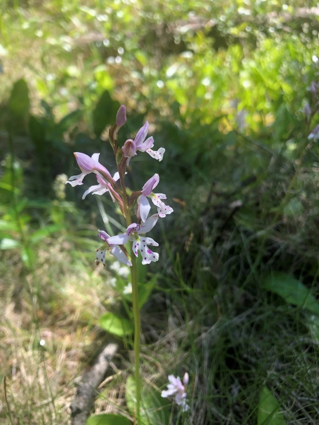
You might remember this from science class, but a quick refresher: amphibians are vertebrates that live in water and on land. They are ectothermic, which means they are unable to regulate their body temperature and must move between warmer and cooler environments to change their body temperature. They also have very thin skin that absorbs oxygen, water, and chemicals. For this reason, amphibians are quite sensitive to human activities that change their habitat, and are known as ‘biological indicator species,’ which means their health reflects the health of waterways, wetlands, and uplands they live in. Frogs, salamanders, and toads are the 3 types of amphibians found in Alberta.

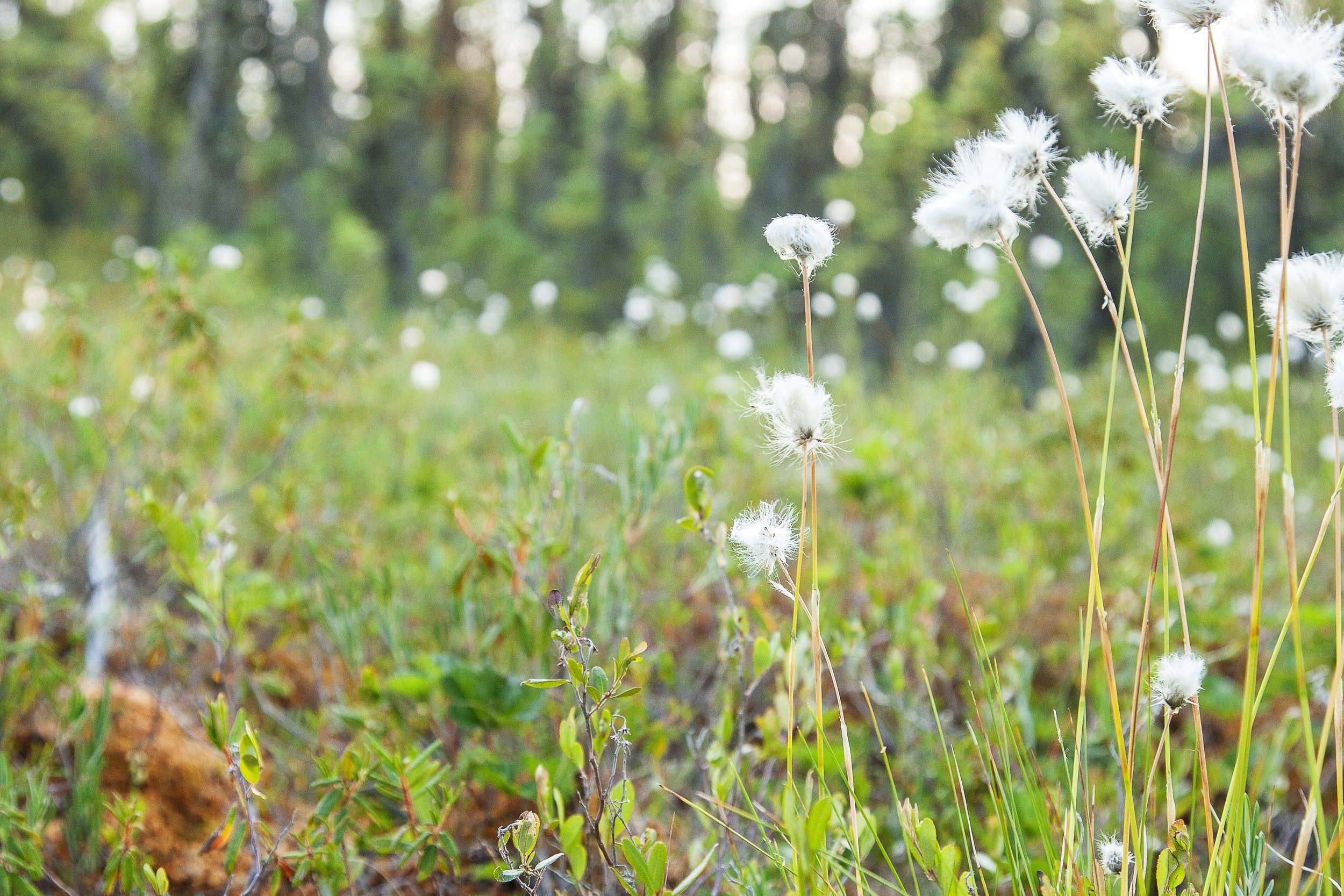
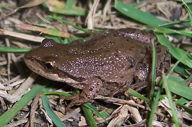
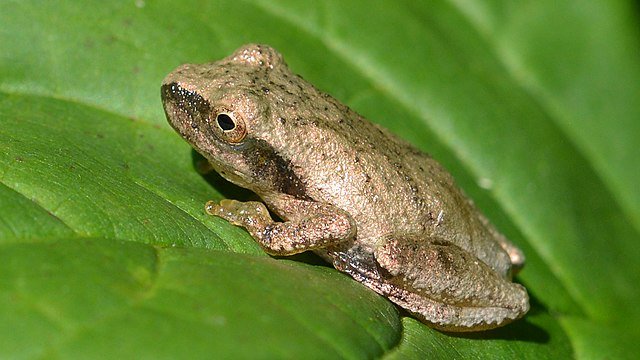
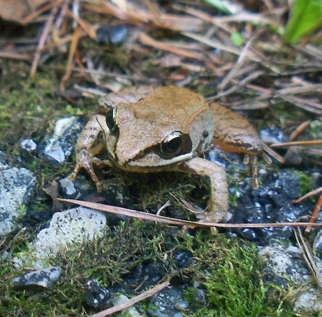
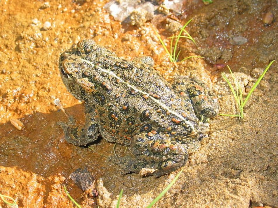
The boreal chorus frog is a small frog commonly found in wetlands across Canada, even in habitat outside of the boreal, despite its name! This frog has the unique ability to freeze solid in the winter and hop back to life come springtime. Other amphibian species that are known to exist around Grand Prairie are the wood frog, which is distinguishable by a white stripe on its upper lip, and the western toad, which is larger and bumpier than the frogs described above (Figure 2).

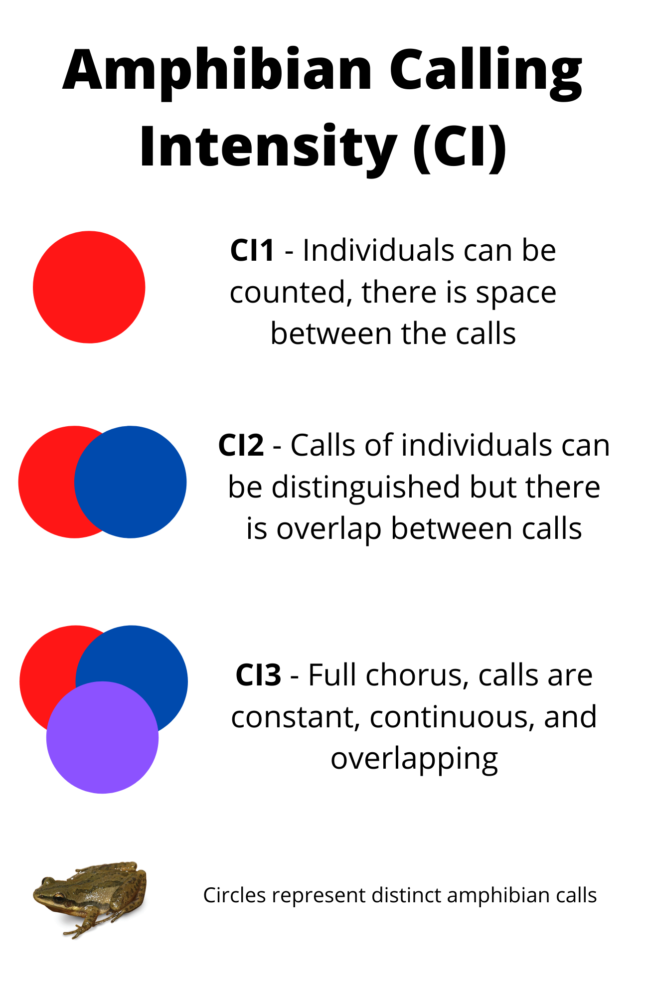
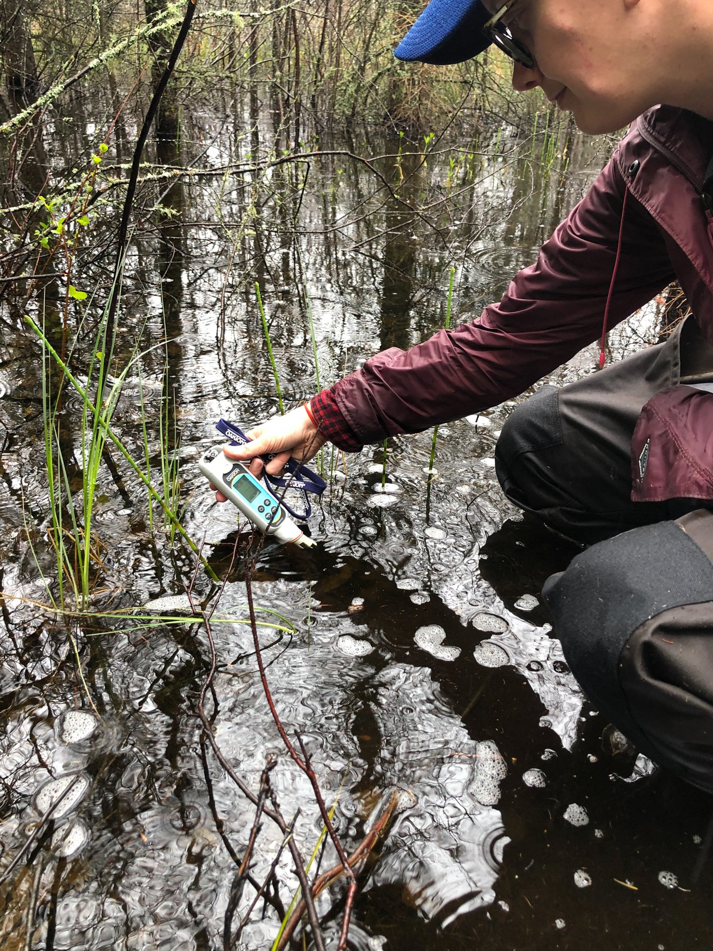
The boreal chorus frog looks very similar to the western chorus frog, the spring peeper, and the pacific tree frog, all of which are not found in Alberta, but in Southwestern British Columbia. We bring this up because it’s a good example to show that the best way to differentiate these frogs is by their call: the boreal chorus frog has a shorter and faster call than that of the western chorus frog. This is why ARUs are so important in amphibian research.

Figure 2: Boreal amphibians.

1. Boreal chorus frog - Tnarg 12345

2. Spring peeper - Ryan Hodnett

3. Western chorus frog - Mark Nenedov

4. Wood frog - Emilyk

5. Pacific tree frog - The High Fin Sperm Whale

6. Western toad - MBerg


Studying frogs – using devices that can record their calls:

From May 14th to August 28th, 2020, amphibian calls were monitored at the Wetland Centre in the county of Grand Prairie, Alberta . During the spring breeding season, males produce auditory calls (think ribit-ribit) to attract females, making it the ideal period to put out ARUs and determine who is there. This event draws many frogs to one location (always near water), making it difficult to distinguish individuals. The ABMI uses WildTrax—a software to store and analyze the sound recordings collected by ARUs. Observers identify species by their calls and assess calling intensity, a metric used to estimate amphibian abundance. Calling intensity is determined from the number of calls recorded over a certain time period (Figure 3). For more information, visit the acoustic tagging methods page on WildTrax.

Figure 3: Amphibian calling intensities.

ARUs collect a tremendous amount of data that would take months or years to fully listen to. So, the ABMI uses a sub-sampling method where randomly selected one-minute transcriptions, or sections, of the ARU recordings at midnight and 2 am were analyzed. Calling intensity estimates were made from recordings taken at these times as amphibians are most active at night when the risk of predation is lower. Recall that amphibians regulate their body temperature and have very sensitive skin that could easily dry out during the day, making moist nighttime conditions more suitable for them. For the same reason, we would expect to record a higher calling intensity (remember the overlapping circles in Figure 1) while conditions are wet, and a lower calling intensity as temperatures rise.

Interestingly, the boreal chorus frog was the only amphibian species recorded, despite the Wetland Centre existing within the ranges of the wood frog and the western toad (Table 1, Figure 4). This may be due to the sensitivity of other amphibian species to disturbances as the Wetland Center exists in a semi-urban area and the Evergreen Park has regular visitors. However, only 30% of ARU recordings will pick up amphibian calls at all, and only around 6% will pick up those of multiple species. Recall that a random sub-sampling method was used to select the recordings analyzed, which means it is possible that: (1) other species were there, but weren’t calling during the recording sessions, or (2) that their calls were captured by the ARUs but were not randomly selected for analysis.

While the ARUs and random sub-sampling methods were set up to record amphibians, various bird species were incidentally recorded. These observations should not be considered a comprehensive list of birds present in the area. Various abiotic (non-living) sounds, such as rain and industrial noise, were also recorded due to the use of the Evergreen Park for various groups and events (Table 1). These abiotic sounds were the only sounds recorded in July and August as amphibian calling intensity declined (Figure 4), likely due to the breeding season ending in June. After this season, many amphibian species return to cool and moist forest understories or similar habitats. 

Table 1: Species and noises recorded

Figure 4: Cumulative amphibian calling intensity (CI1 + C12 = 3) over the study period (May-August). Note: amphibian abundance does not directly translate to the count of individuals as there may be overlap in recorded calls. This graph is meant to display the change in calling intensity over time, not to estimate amphibian abundance.

As expected, a higher calling intensity (CI3) was recorded shortly after the largest rainfall event recorded in the study period (13.7 mm on May 21st) (Table 2), while calling intensity declined as temperatures approached 20°C in June (Table 2).

Table 2: Amphibian species calling intensity, temperature and precipitation data from May 15th- June 20th, 2020. Note: all recorded amphibian calls were from boreal chorus frogs.

Overall, this 4-month amphibian monitoring project revealed that the boreal chorus frog is the most abundant amphibian species at the Wetland center, if not the only amphibian species (Table 1, Figure 4). Visitors have the greatest chance of seeing or hearing this species in May and June. In 2020, May 16, 24 and 28th had the highest calling intensity (remember Figure 1), and June 20th was the last date that an amphibian call was recorded.

If you come across a species you need help identifying, check out the Naturelynx app by ABMI. By recording your observations, you can help us learn more about the species - amphibians and otherwise - at the Wetland Centre.

References:

Alberta Biodiversity Monitoring Institute (ABMI). 2019. Terrestrial ABMI autonomous recording unit and remote camera trap protocols. https://abmi.ca/home/publications/551-600/56

Alberta Conservation Association. Amphibian Identification. https://www.abconservation.com/avamp/          identification-keys/juvenile-and-adult-amphibians-of-alberta/

Call of the wetland. 2019. Identify an amphibian. https://callofthewetland.ca/amphibian-identification/


We are hiring!

Want to work at the Wetland Centre? Ducks Unlimited Canada (DUC) is hiring a Conservation Programs Specialist II based in Grande Prairie, Alberta. This is a full time 3-year term position, with 50% of the work allocated to Wetland Centre projects/activities. Read the job posting here: https://www.ducks.ca/careers/conservation-programs-specialist-ii-3-yr-term/


Wetland Centre Summer 2021 Bioblitz

From July 22nd to 25th 2021, Ducks Unlimited Canada and the Alberta Biodiversity Monitoring Institute hosted a free citizen science event at the Evergreen Park in the County of Grande Prairie. Using the user-friendly app Naturelynx , participants were equipped to capture and document as many observations as possible. This time around, 51 observations were recorded over the four days, all of which happened to be plant species.

A bioblitz is a great way for nature enthusiasts of all age, skill, and interest levels to familiarize themselves with the diversity of flora and fauna in an area. Each species identified in the specified time period contributes to an improved understanding of the flora and fauna present at the Wetland Center. Here are some of the beautiful species captured:

Sticky False Asphodel (Triantha glutinosa) captured 07/24/21 by Valerie.Also known as Northern bog asphodel, this species is typically found in fens and marshes.

Sticky False Asphodel (Triantha glutinosa) captured 07/24/21 by Valerie.

Also known as Northern bog asphodel, this species is typically found in fens and marshes.

Northern grass-of-Parnassus (Parnassia palustris) captured 07/24/21 by Valerie.This showy forb comes in four varieties and is typically found in fens, marshes, lake or river shores.

Northern grass-of-Parnassus (Parnassia palustris) captured 07/24/21 by Valerie.

This showy forb comes in four varieties and is typically found in fens, marshes, lake or river shores.

Northern Bastard Toadflax (Geocaulon lividum) captured 07/24/21 by Angie KuystersThis plant produces food through photosynthesis and steals nutrients from surrounding plants through its underground root suckers, making it a hemi parasitic species. This species is common across the Boreal forest – typically in bogs and fens.

Northern Bastard Toadflax (Geocaulon lividum) captured 07/24/21 by Angie Kuysters

This plant produces food through photosynthesis and steals nutrients from surrounding plants through its underground root suckers, making it a hemi parasitic species. This species is common across the Boreal forest – typically in bogs and fens.

Missed this Bioblitz but want to contribute your observations? Click here to join our Naturelynx group where you can participate anytime and watch for future BioBlitz at the Wetland Center!

A Day in the Field at the Wetland Centre with DUC Staff

DUC staff members Leanne and Catherine set off to do some work at the Wetland Centre. Keep reading to get a glimpse into their day in the field!


In early August we travelled to the Wetland Centre to maintain some of the citizen science infrastructure, install new equipment and check out the new signs that were recently installed - like this one at the site entrance.

IMG_1567.JPG

After an initial walk-through of the site, we set to work deploying data loggers that will automatically collect water level measurements as part of the Wetland Hydrology Monitoring project.  We’re using this data to better understand how water levels change over time in different wetland classes. The data collected from the iWetland citizen science project wells will also help support this.

At our third site, we were reminded that sometimes things don’t go according to plan.  With a dry summer, the water level was too low in the well we originally picked to install a data logger at. So, we installed a new, deeper well in a different wetland and were then able to install the data logger.

Next, we measured peat depths to fine-tune our wetland maps of the site.  In doing so, we tested out a new tool – an avalanche probe!  The probe should easily push through peat soils, but not the underlying mineral soils, to give us an estimate of peat depth. Because this is a new-to-us tool, we brought a soil auger to double-check our depth estimates.  We found that while the avalanche probe worked in many areas, it was challenging to discern the difference between peat soils and very wet clay soils.  If you can’t detect this transition, you can easily overestimate the depth of the peat. It was a great opportunity to test this new tool but until we get a feel for the changes in soil type, we’ll be using the auger to confirm these measurements.

Installing a new hydrology well

Installing a new hydrology well

Testing out the avalanche probe

We also re-installed several trail cameras throughout the site.  We’ve been using these not only to capture wildlife photos but also to capture changes in plant growth and hydrology in three different wetland types - a marsh, fen, and swamp.

We had a great day getting out of the office and into the field at the Wetland Centre.  With maintenance tasks and equipment installation checked off for the season, we’re now looking at compiling and analyzing the water level, peat depth, and trail camera data collected- and as always… planning for what comes next!

wetlandcentrelast.jpg
IMG_2109.JPG

Postponed - Wetland Centre Spring 2020 Workshop

evergreensplice.jpg

The Wetland Centre Spring 2020 Workshop has been postponed due to the COVID-19 situation. We hope to hold this event in the fall, sign up for our newsletter to be notified or check back for for the new date .

The Evergreen Learning and Innovation Society (ELIS) and Ducks Unlimited Canada’s National Boreal Program (DUC) invite you to a free full-day Wetlands Workshop on April 21, 2020. This workshop is in support of the Wetland Centre at Evergreen Park project and will build on the success and outcomes of last year’s workshop.

Register here.

The purpose of the workshop is to showcase and discuss examples of community, training, and research projects with the goal of: 1. raising awareness and understanding of Alberta’s boreal wetlands, and 2. informing the development of and activities at the Wetland Centre.

Key themes for the spring 2020 workshop include:

  • Wetland literacy – share information about boreal wetland types, functions, and values

  • Learning from experience – examples of community, training, and research projects

  • Bridging traditional wetland knowledge and western science

  • Wetland Centre project – update on what has been done and what comes next

This event is made possible by the generous support of our workshop sponsors, Hammerhead Resources Inc. and Pembina Pipelines.

Hammerhead.png
Pembina.jpg

Why should you attend?

Participants will…

  • Learn about boreal wetlands and examples of current wetland training, research, and community projects taking place in Alberta

  • Hear updates on the Wetland Centre project and opportunities to get involved

  • Generate ideas for conducting new research, demonstrations, training, and other wetland programming at the Wetland Centre

  • Explore opportunities for bridging traditional wetland knowledge and western wetland science

  • Network and engage with a diverse group of stakeholders with shared interests in wetland conservation, education, management, and reclamation.

Who should attend?

Anyone interested in the intersection of boreal wetlands and resource management in Alberta’s boreal should consider attending this workshop. We welcome anyone who is interested in learning more and contributing ideas, including:

  • Industry

  • Government

  • Indigenous communities

  • Researchers

  • Contractors and consultants

  • Educators

  • NGOs and associations

  • Anyone wanting to set up a booth to share information

  • Anyone else!

Workshop deliverables

Proceedings from the workshop will be distributed to participants and will include summaries of the day’s discussions.


How Remote Sensing is Used to Map Wetlands: Evergreen Park Wetland Mapping Extension Project

Becky Edwards, DUC (on Twitter @Becky_Maps)

Over the past 20 years, Ducks Unlimited Canada’s (DUC) National Boreal Program has been the leading force in providing detailed and accurate wetland mapping inventories for the boreal forest. To date, DUC has mapped approximately 200 million acres of wetlands using remote sensing techniques. Since 2015, DUC has worked with the Evergreen Learning and Innovation Society (ELIS), and as part of this relationship DUC’s remote sensing team produced the first wetland classification at the Evergreen Park in 2016. Recently, as a result of the Wetland Centre project, there was an opportunity for DUC to map additional wetlands at Evergreen Park.

2016 Wetland Classification at Evergreen Park, AB with 2019 wetland mapping study area outlined in Red. ©DUC

2016 Wetland Classification at Evergreen Park, AB with 2019 wetland mapping study area outlined in Red. ©DUC

What is Remote Sensing?

Remote sensing is the science of obtaining information about an object or area without being able to see or touch the object. Remote sensing information is typically gathered by satellites, fixed-wing, rotary aircrafts or drones. For the Evergreen Park project we made use of existing data sources collected by fixed-wing aircrafts and available from the County of Grande Prairie open data portal including, high-resolution aerial photos and lidar imagery at a resolution of 10 – 25 cm. Lidar uses light in the form of a pulsed laser to create high-resolution elevation products that can help distinguish wetland boundaries and wetland type. Lidar imagery can identify depressions on the landscape where water may collect, forming a wetland. In the image below, the darker tones on the right side of the Lidar image are low-lying flat areas. Whereas, the brighter tones represent higher-elevation uplands.

Left: aerial photo with a 10 cm resolution. Right: LiDAR data with a 10 cm resolution. The dark areas of the LiDAR imagery are depressions in the landscape whereas the white areas depict higher elevated terrain (canopy or high ground). ©DUC

Left: aerial photo with a 10 cm resolution. Right: LiDAR data with a 10 cm resolution. The dark areas of the LiDAR imagery are depressions in the landscape whereas the white areas depict higher elevated terrain (canopy or high ground). ©DUC

Using a combination of Lidar and high-resolution aerial photos we can classify wetland types based on the category of vegetation present (e.g., conifer vs. deciduous vs. graminoid [grass/sedge]) and its height. Nine wetland types were identified at Evergreen Park as part of the 2016 mapping project and no new wetland types were identified in 2019. These wetland types include: open water, emergent marsh, graminoid, shrubby and treed rich fen, and conifer, mixed wood, tamarack and hardwood swamp. To see photos of the wetland types, visit our previous blog post about exploring the fall wetlands at Evergreen Park.

Field Data Procedures

In addition to satellite imagery, we selected and visited on-the-ground field sites to confirm that what was interpreted in the satellite imagery is representative of what is on the ground. We (Becky Edwards and Leanne Mingo, DUC) conducted site visits at Evergreen Park in September 2019. The goal was to collect wetland data at as many sites as possible during our visit.

Field tablet with satellite imagery and field data. ©DUC

Field tablet with satellite imagery and field data. ©DUC

Each field site processed consisted of:

  1. Collecting a GPS way point at the site location;

  2. Taking pictures of the site;

  3. Filling out a field form and assigning a wetland class using DUC’s Field Guide of Boreal Wetland Classes. Examples of the information collected on the field form included: species present, species aerial coverage, and tree/shrub height; and

  4. Collecting peat depth measurements by inserting a peat probe into the ground until resistance, and record the depth listed on the probe*.

    *It is important to take peat depth measurements because peatlands can store up to 98% of their total carbon below ground and there is a big need in this field to have a better understanding of the volume of peat for various types of boreal wetlands. Therefore, increasing our knowledge of peat and wetland types will increase our understanding of below ground carbon storage.

Left: Field crew taking a peat depth measurement using a peat probe. Right: Peat depth core.

Left: Field crew taking a peat depth measurement using a peat probe. Right: Peat depth core.

Due to the large amount of rain in Grand Prairie over the spring and summer of 2019, many of the wetland sites were too saturated to sample. Some of the tamarack swamp sites had five inches of standing water! In these cases, the field crew walked along the perimeter of the site to collect data.

Creating Maps

Once we returned from the field, I uploaded the data collected to a mapping software, ArcGIS, for analysis. I digitized the wetland boundaries in the project area based on the imagery and the wetland type verified in the field. Digitizing is the process of converting geographic data into vector data (point, line or polygon) by tracing the feature of interest. By using these methods, I produced a wetland inventory showing wetland extent and type across the entire Evergreen Park.

Updated 2019 wetland classification of the Evergreen Park with peat depth measurements.

Updated 2019 wetland classification of the Evergreen Park with peat depth measurements.

What comes next?

Equipped with an improved understanding of the wetlands at Evergreen Park, including mapped wetlands within and adjacent to the Wetland Centre project area AND additional peat depth measurements, we can use this information to help identify and plan future research, training, and demonstration opportunities.

Exploring Fall Wetlands at Evergreen Park

This September, DUC staff and the Wetland Centre project manager visited the Wetland Centre MOU area to map wetlands, measure peat depths, and meet with stakeholders to discuss the project. It’s been a very wet year for much of northern Alberta, and the County of Grande Prairie is no exception. We found tamarack swamps with over 5 inches of standing water and observed waterfowl in the shallow open water and graminoid fen wetlands! Check out some of the photos from our visit:


In addition to exploring and mapping wetlands, we also had the opportunity to meet with stakeholders to learn about their work, challenges working in and around wetlands, and opportunities to work together in the future. We met with the Canadian Forest Service to learn about CFS’ current projects at the Evergreen Learning and Innovation Centre, presented as part of the NAIT Centre for Boreal Research Boreal Nature Series, and met with project supporters Pembina and Keyera.

Jaime (CFS) and Kylie (DUC) are pictured in a graminoid fen.

Jaime (CFS) and Kylie (DUC) are pictured in a graminoid fen.

Becky (DUC, pictured) and Kylie (DUC) presented on Wetland Remote Sensing: a Tool for Wetland Best Management Practices. Kylie and Angie (Wetland Centre Project Manager, Incremental Forest Technologies) followed up with a short presentation on the W…

Becky (DUC, pictured) and Kylie (DUC) presented on Wetland Remote Sensing: a Tool for Wetland Best Management Practices. Kylie and Angie (Wetland Centre Project Manager, Incremental Forest Technologies) followed up with a short presentation on the Wetland Centre.

Stay tuned for our next post to learn how we mapped wetlands at the Centre!

Workshop re-cap: Introduction to the Wetland Centre at Evergreen Park

A full summary of the Wetland Centre workshop can be found here. For more information about the Wetland Centre project, sign-up for our mailing list and check back for future blog posts.

On April 24, 2019 the Evergreen Learning and Innovation Centre and Ducks Unlimited Canada hosted an introductory workshop for the Wetland Centre project. Over 35 attendees from industry, provincial and municipal government, First Nations communities, non-profit, consultants and contractors, and other groups and backgrounds gathered to learn about the project and share their ideas.

WorkshopPresentation2019

The purpose of the Wetland Centre workshop was to provide attendees with information about the organizations involved (ELIS and DUC), about the project, and provide an opportunity for interested parties to get involved early and to help shape the future of the Wetland Centre.

What we heard

Workshop participants attended the workshop for a range of reasons including interest in wetlands and wetland best management practices, in learning about the Wetland Centre project and being involved from the ground up, and in meeting with and learning from other individuals and organizations also interested in wetlands.

Over the course of the day, participants had the opportunity to discuss what brought them to the workshop, their current challenges and opportunities with respect to wetlands, and their ideas for what a Wetland Centre at Evergreen Park could be. Participants learned about the project leads, the Wetland Centre project, and next steps as part of introductory presentations.

These presentations and summaries of the discussions are included in the Workshop Proceedings (link). At the end of the day, participants toured the Evergreen Learning and Innovation Centre to get an idea of the types of activities that could be hosted at the Wetland Centre.

WorkshopEvergreenCentre_2019

What we learned

The number and diversity of participants resulted in excellent discussions about boreal wetlands including operational challenges, research and training opportunities, and potential directions for the Wetland Centre.

From the day’s discussions we learned that there is interest in:

  1. Having an on-the-ground location to share information about wetlands including wetland values, functions, challenges, and approaches to avoiding, minimizing, or reclaiming, with a wide variety of audiences.

  2. Using an on-the-ground location as a hub to bring together diverse groups to share information about wetlands, address common challenges, and develop and showcase innovative technologies for wetland avoidance, minimization, and reclamation/ restoration.

  3. Showcasing traditional knowledge, bringing together western science and traditional knowledge, and creating opportunities for Indigenous perspectives as part of developing the Wetland Centre.

  4. Regular project communications to share information about project developments and opportunities for involvement. Participants are interested in receiving information via digital communications (e.g., website, newsletter, social media), hosting a regular event/ workshop, and attending community events to share information about the project.

  5. Understanding funding opportunities and constraints and developing an effective governance structure to ensure the Wetland Centre is financially and functionally sustainable in the long-term.

Where we’re going next

As follow-up to the Wetland Centre workshop we committed to sharing the workshop proceedings and presentations. To do so, and to have a place to share future updates, we created this website! Read more about next steps in the proceedings document.

As part of carrying out Year 1 project activities, and to meet the requirements of the Provincial Court of Alberta funding, the project team will develop a ‘living’ Strategic Plan by August 2019. As part of carrying out Year 2 (September 2019 – August 2020) project activities, the project team will work on site access and development and will lay the ground work for potential research and demonstration projects. Based on what we heard at the workshop we will also explore approaches for incorporating Indigenous knowledge and values into the Wetland Centre.  

To explore the path forward for the Wetland Centre beyond the scope of the three-year Provincial Court of Alberta funded project we will assemble a small advisory group.

How can you get involved?

  • Keep up to date with progress on the Wetland Centre project – read the workshop proceedings and presentations, sign up for the new Wetland Centre newsletter, and keep an eye on this site for updates, news, and events.

  • Share information about the Wetland Centre with others – help us raise awareness and ensure the right groups are at the table to carry out the Wetland Centre project and plan for the future of the Wetland Centre.

  • Share your ideas for potential projects – is there a project you’re looking to lead that the could fit with the Wetland Centre? We’re interested in hearing about potential wetland research, demonstration, training or other projects that could utilize the site.

  • Help us fund the Wetland Centre and plan for the long-term – for the Wetland Centre to be successful beyond the three-year project, we will need to build a community of in-kind and financial supporters. In addition to assembling and working with a small advisory group, we are interested in hearing your ideas.

  • Keep in touch – contact us with questions, events or projects that may be a good fit, or anything else you think would be helpful for us to know about.

Thank you to our workshop sponsor Keyera

Keyera.png