


Wetland Centre has been busy: Summer Update
/
This summer the Wetland Centre project team has been working hard revitalizing the Evergreen Centre site. Find out more in the latest news update.
Read MoreWe are on Linked-In! Join the Boreal Wetland Centre Group to learn more!
Want to know what events are coming up at The Boreal Wetland Centre? Check out our Events page.
This summer the Wetland Centre project team has been working hard revitalizing the Evergreen Centre site. Find out more in the latest news update.
Read More
The Wetland Centre Spring 2020 Workshop has been postponed due to the COVID-19 situation. We hope to hold this event in the fall, sign up for our newsletter to be notified or check back for for the new date .
The Evergreen Learning and Innovation Society (ELIS) and Ducks Unlimited Canada’s National Boreal Program (DUC) invite you to a free full-day Wetlands Workshop on April 21, 2020. This workshop is in support of the Wetland Centre at Evergreen Park project and will build on the success and outcomes of last year’s workshop.
The purpose of the workshop is to showcase and discuss examples of community, training, and research projects with the goal of: 1. raising awareness and understanding of Alberta’s boreal wetlands, and 2. informing the development of and activities at the Wetland Centre.
Key themes for the spring 2020 workshop include:
Wetland literacy – share information about boreal wetland types, functions, and values
Learning from experience – examples of community, training, and research projects
Bridging traditional wetland knowledge and western science
Wetland Centre project – update on what has been done and what comes next
This event is made possible by the generous support of our workshop sponsors, Hammerhead Resources Inc. and Pembina Pipelines.


Why should you attend?
Participants will…
Learn about boreal wetlands and examples of current wetland training, research, and community projects taking place in Alberta
Hear updates on the Wetland Centre project and opportunities to get involved
Generate ideas for conducting new research, demonstrations, training, and other wetland programming at the Wetland Centre
Explore opportunities for bridging traditional wetland knowledge and western wetland science
Network and engage with a diverse group of stakeholders with shared interests in wetland conservation, education, management, and reclamation.
Who should attend?
Anyone interested in the intersection of boreal wetlands and resource management in Alberta’s boreal should consider attending this workshop. We welcome anyone who is interested in learning more and contributing ideas, including:
Industry
Government
Indigenous communities
Researchers
Contractors and consultants
Educators
NGOs and associations
Anyone wanting to set up a booth to share information
Anyone else!
Workshop deliverables
Proceedings from the workshop will be distributed to participants and will include summaries of the day’s discussions.
Becky Edwards, DUC (on Twitter @Becky_Maps)
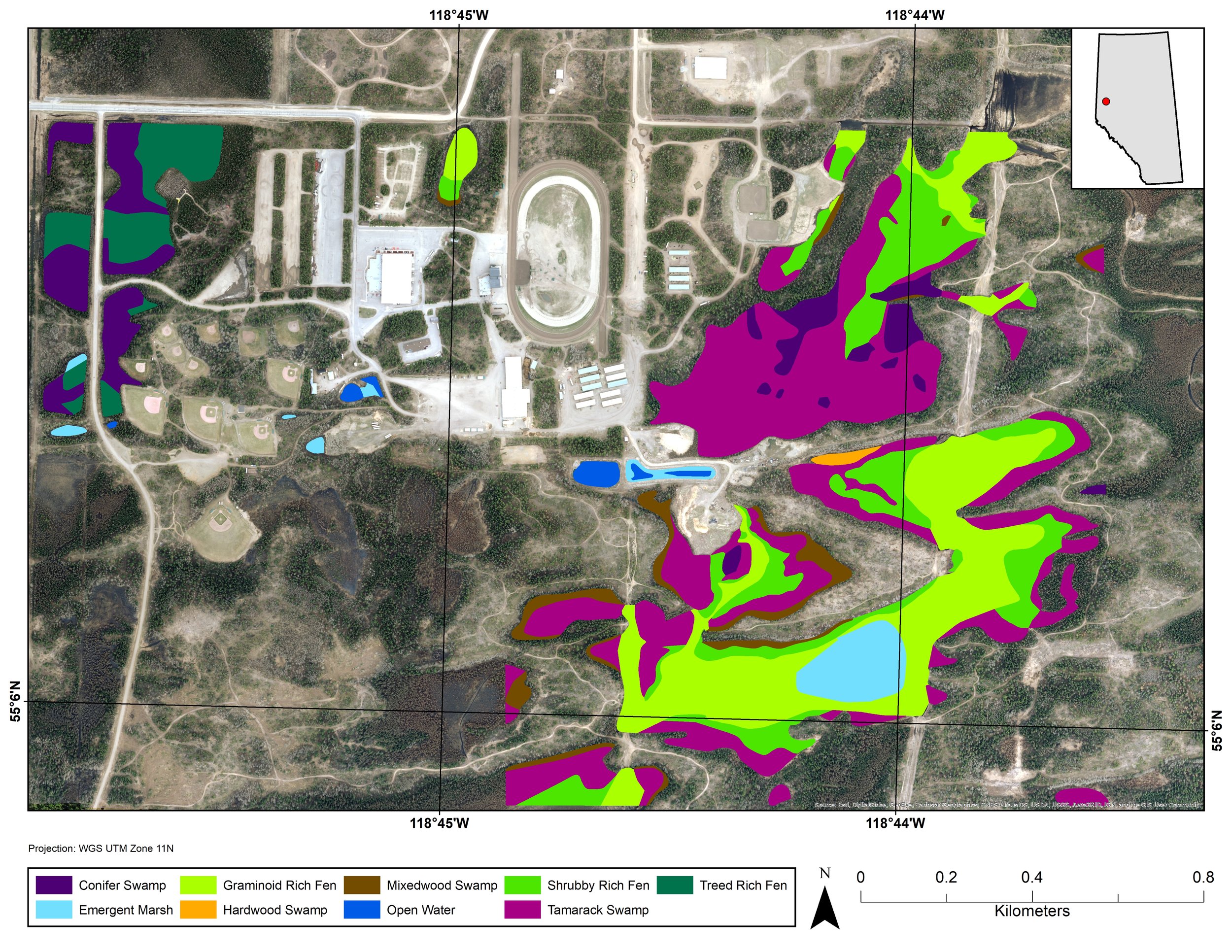
Over the past 20 years, Ducks Unlimited Canada’s (DUC) National Boreal Program has been the leading force in providing detailed and accurate wetland mapping inventories for the boreal forest. To date, DUC has mapped approximately 200 million acres of wetlands using remote sensing techniques. Since 2015, DUC has worked with the Evergreen Learning and Innovation Society (ELIS), and as part of this relationship DUC’s remote sensing team produced the first wetland classification at the Evergreen Park in 2016. Recently, as a result of the Wetland Centre project, there was an opportunity for DUC to map additional wetlands at Evergreen Park.

2016 Wetland Classification at Evergreen Park, AB with 2019 wetland mapping study area outlined in Red. ©DUC
What is Remote Sensing?
Remote sensing is the science of obtaining information about an object or area without being able to see or touch the object. Remote sensing information is typically gathered by satellites, fixed-wing, rotary aircrafts or drones. For the Evergreen Park project we made use of existing data sources collected by fixed-wing aircrafts and available from the County of Grande Prairie open data portal including, high-resolution aerial photos and lidar imagery at a resolution of 10 – 25 cm. Lidar uses light in the form of a pulsed laser to create high-resolution elevation products that can help distinguish wetland boundaries and wetland type. Lidar imagery can identify depressions on the landscape where water may collect, forming a wetland. In the image below, the darker tones on the right side of the Lidar image are low-lying flat areas. Whereas, the brighter tones represent higher-elevation uplands.

Left: aerial photo with a 10 cm resolution. Right: LiDAR data with a 10 cm resolution. The dark areas of the LiDAR imagery are depressions in the landscape whereas the white areas depict higher elevated terrain (canopy or high ground). ©DUC
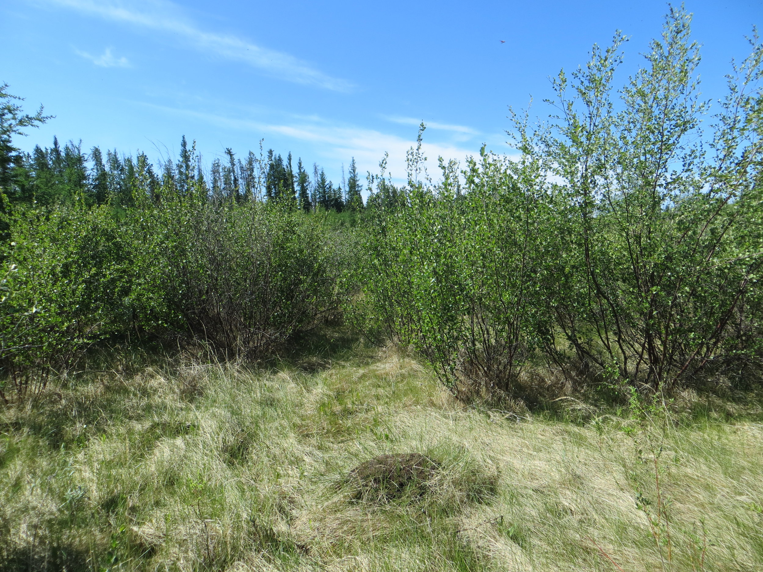
Using a combination of Lidar and high-resolution aerial photos we can classify wetland types based on the category of vegetation present (e.g., conifer vs. deciduous vs. graminoid [grass/sedge]) and its height. Nine wetland types were identified at Evergreen Park as part of the 2016 mapping project and no new wetland types were identified in 2019. These wetland types include: open water, emergent marsh, graminoid, shrubby and treed rich fen, and conifer, mixed wood, tamarack and hardwood swamp. To see photos of the wetland types, visit our previous blog post about exploring the fall wetlands at Evergreen Park.
Field Data Procedures
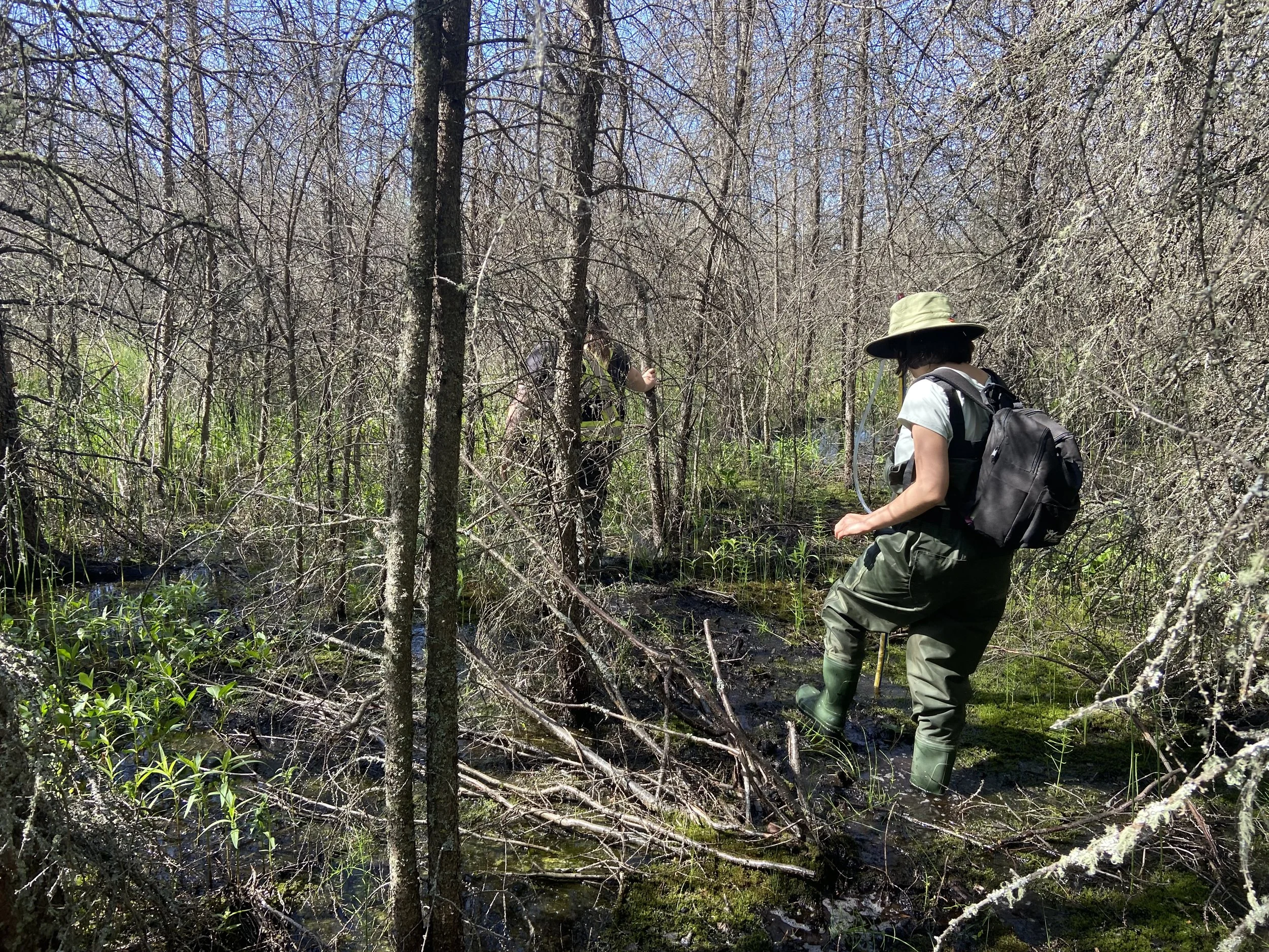
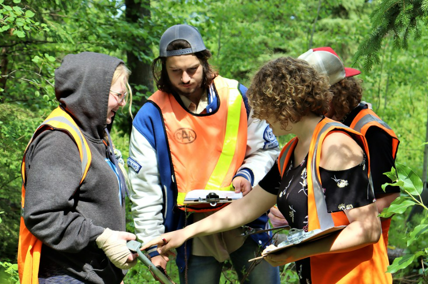
In addition to satellite imagery, we selected and visited on-the-ground field sites to confirm that what was interpreted in the satellite imagery is representative of what is on the ground. We (Becky Edwards and Leanne Mingo, DUC) conducted site visits at Evergreen Park in September 2019. The goal was to collect wetland data at as many sites as possible during our visit.

Field tablet with satellite imagery and field data. ©DUC
Each field site processed consisted of:
Collecting a GPS way point at the site location;
Taking pictures of the site;
Filling out a field form and assigning a wetland class using DUC’s Field Guide of Boreal Wetland Classes. Examples of the information collected on the field form included: species present, species aerial coverage, and tree/shrub height; and
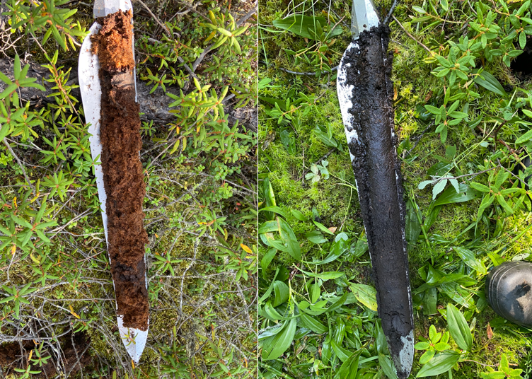
Collecting peat depth measurements by inserting a peat probe into the ground until resistance, and record the depth listed on the probe*.
*It is important to take peat depth measurements because peatlands can store up to 98% of their total carbon below ground and there is a big need in this field to have a better understanding of the volume of peat for various types of boreal wetlands. Therefore, increasing our knowledge of peat and wetland types will increase our understanding of below ground carbon storage.

Left: Field crew taking a peat depth measurement using a peat probe. Right: Peat depth core.
Due to the large amount of rain in Grand Prairie over the spring and summer of 2019, many of the wetland sites were too saturated to sample. Some of the tamarack swamp sites had five inches of standing water! In these cases, the field crew walked along the perimeter of the site to collect data.
Creating Maps
Once we returned from the field, I uploaded the data collected to a mapping software, ArcGIS, for analysis. I digitized the wetland boundaries in the project area based on the imagery and the wetland type verified in the field. Digitizing is the process of converting geographic data into vector data (point, line or polygon) by tracing the feature of interest. By using these methods, I produced a wetland inventory showing wetland extent and type across the entire Evergreen Park.

Updated 2019 wetland classification of the Evergreen Park with peat depth measurements.
What comes next?
Equipped with an improved understanding of the wetlands at Evergreen Park, including mapped wetlands within and adjacent to the Wetland Centre project area AND additional peat depth measurements, we can use this information to help identify and plan future research, training, and demonstration opportunities.
A full summary of the Wetland Centre workshop can be found here. For more information about the Wetland Centre project, sign-up for our mailing list and check back for future blog posts.
On April 24, 2019 the Evergreen Learning and Innovation Centre and Ducks Unlimited Canada hosted an introductory workshop for the Wetland Centre project. Over 35 attendees from industry, provincial and municipal government, First Nations communities, non-profit, consultants and contractors, and other groups and backgrounds gathered to learn about the project and share their ideas.

The purpose of the Wetland Centre workshop was to provide attendees with information about the organizations involved (ELIS and DUC), about the project, and provide an opportunity for interested parties to get involved early and to help shape the future of the Wetland Centre.
Workshop participants attended the workshop for a range of reasons including interest in wetlands and wetland best management practices, in learning about the Wetland Centre project and being involved from the ground up, and in meeting with and learning from other individuals and organizations also interested in wetlands.
Over the course of the day, participants had the opportunity to discuss what brought them to the workshop, their current challenges and opportunities with respect to wetlands, and their ideas for what a Wetland Centre at Evergreen Park could be. Participants learned about the project leads, the Wetland Centre project, and next steps as part of introductory presentations.
These presentations and summaries of the discussions are included in the Workshop Proceedings (link). At the end of the day, participants toured the Evergreen Learning and Innovation Centre to get an idea of the types of activities that could be hosted at the Wetland Centre.

The number and diversity of participants resulted in excellent discussions about boreal wetlands including operational challenges, research and training opportunities, and potential directions for the Wetland Centre.
From the day’s discussions we learned that there is interest in:
Having an on-the-ground location to share information about wetlands including wetland values, functions, challenges, and approaches to avoiding, minimizing, or reclaiming, with a wide variety of audiences.
Using an on-the-ground location as a hub to bring together diverse groups to share information about wetlands, address common challenges, and develop and showcase innovative technologies for wetland avoidance, minimization, and reclamation/ restoration.
Showcasing traditional knowledge, bringing together western science and traditional knowledge, and creating opportunities for Indigenous perspectives as part of developing the Wetland Centre.
Regular project communications to share information about project developments and opportunities for involvement. Participants are interested in receiving information via digital communications (e.g., website, newsletter, social media), hosting a regular event/ workshop, and attending community events to share information about the project.
Understanding funding opportunities and constraints and developing an effective governance structure to ensure the Wetland Centre is financially and functionally sustainable in the long-term.
As follow-up to the Wetland Centre workshop we committed to sharing the workshop proceedings and presentations. To do so, and to have a place to share future updates, we created this website! Read more about next steps in the proceedings document.
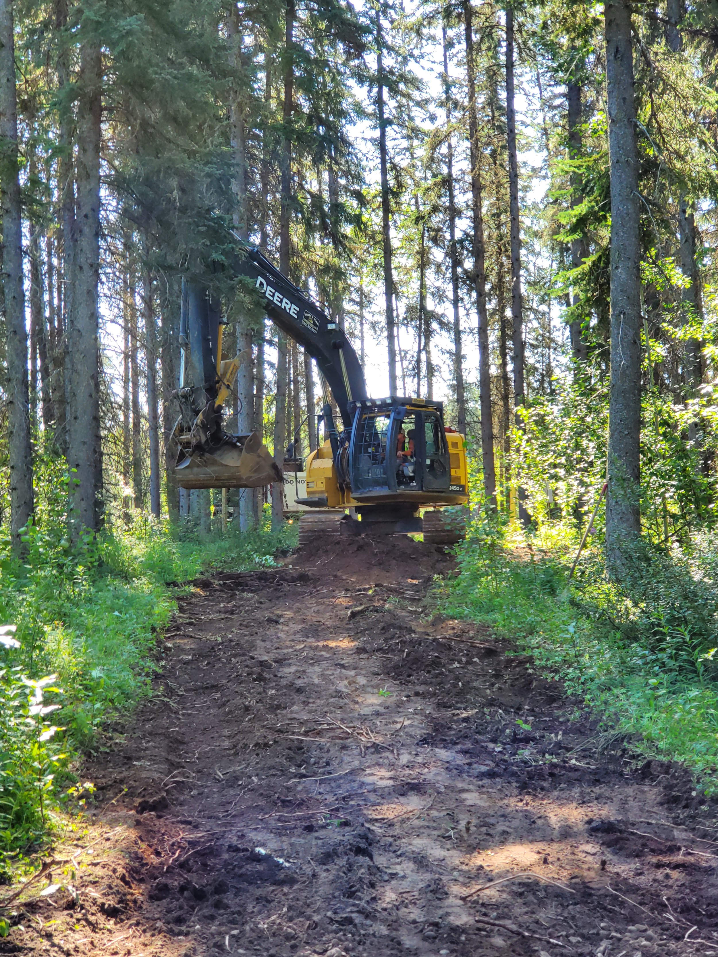
As part of carrying out Year 1 project activities, and to meet the requirements of the Provincial Court of Alberta funding, the project team will develop a ‘living’ Strategic Plan by August 2019. As part of carrying out Year 2 (September 2019 – August 2020) project activities, the project team will work on site access and development and will lay the ground work for potential research and demonstration projects. Based on what we heard at the workshop we will also explore approaches for incorporating Indigenous knowledge and values into the Wetland Centre.
To explore the path forward for the Wetland Centre beyond the scope of the three-year Provincial Court of Alberta funded project we will assemble a small advisory group.
Keep up to date with progress on the Wetland Centre project – read the workshop proceedings and presentations, sign up for the new Wetland Centre newsletter, and keep an eye on this site for updates, news, and events.
Share information about the Wetland Centre with others – help us raise awareness and ensure the right groups are at the table to carry out the Wetland Centre project and plan for the future of the Wetland Centre.
Share your ideas for potential projects – is there a project you’re looking to lead that the could fit with the Wetland Centre? We’re interested in hearing about potential wetland research, demonstration, training or other projects that could utilize the site.
Help us fund the Wetland Centre and plan for the long-term – for the Wetland Centre to be successful beyond the three-year project, we will need to build a community of in-kind and financial supporters. In addition to assembling and working with a small advisory group, we are interested in hearing your ideas.
Keep in touch – contact us with questions, events or projects that may be a good fit, or anything else you think would be helpful for us to know about.
The Evergreen Learning and Innovation Society (ELIS) and Ducks Unlimited Canada’s National Boreal Program (DUC) are collaborating to establish a Wetland Centre here at Evergreen Park. The Wetland Centre will be an outdoor, hands-on centre that can be used for wetlands related training, research, and industry demonstrations.
ELIS and DUC have received funding for a three-year project (starting September 2018) to establish a Wetland Centre at Evergreen Park. The Wetland Centre will build on the reputation, location and partnerships of the Evergreen Centre. Over the next three years we will be:
Year 1, Planning: Developing, with involvement from stakeholders, a Strategic Plan for a Wetland Centre at Evergreen Park.
Year 2, Building: Building support and partnerships and initiate site development (e.g., access, fencing, signage).
Year 3, Implementing: Starting to implement the Strategic Plan so that activities such as site visits and wetlands training can be carried out at the Wetland Centre in the third year. Secure financial support for the Wetland Centre to continue to operate beyond the term of the project.
In November DUC & ELIS hired Angie Kuysters with Incremental Forest Technologies (IFTech) as the Wetland Centre Project Manager. Angie is a long-term resident of the Grande Prairie area and brings experience in strategic planning from her previous work in the forest industry as well as practical, hands-on skills, a dedication to sustainability of our adapting forests, and a belief in continual learning. We are very excited to have Angie on board.
As part of Year 1 strategic planning activities DUC and ELIS will be hosting a stakeholder workshop at Evergreen Park on April 24th, 2019.
This is your opportunity to get involved early and to help shape the future of the Wetland Centre. Participants will…
Learn about the plans for the Wetland Centre project and opportunities to get involved
Interact with other participants from a range of sectors to discuss potential ideas and uses for the Wetland Centre
Generate ideas for conducting new research, demonstrations, training, and other wetlands programming at the Wetland Centre
Provide input that will inform the future direction and activities of the Wetland Centre
Learn about boreal wetlands, meet the project leads, and take part in a tour of the Evergreen Centre
Anyone interested in the intersection of boreal wetlands and resource management in Alberta’s boreal should consider attending this workshop. We envision the Wetland Centre as a location for demonstrations, education and training, research, and more, but we want to hear your needs and ideas. Register here
The success of the Wetland Centre depends on the involvement of potential users like you. For more information about the Wetland Centre project or to find out how you can be involved contact:
Angie Kusters, Wetland Centre Project Manager
Incremental Forest Technologies
Angie (at) iftech.ca
(780) 832–1956
Primary funding for the Wetland Centre project is resulting from a Provincial Court of Alberta sentencing order for an Environmental Protection and Enhancement Act infraction. We thank our workshop sponsor Keyera, and project contributor Pembina Pipelines for their financial support.
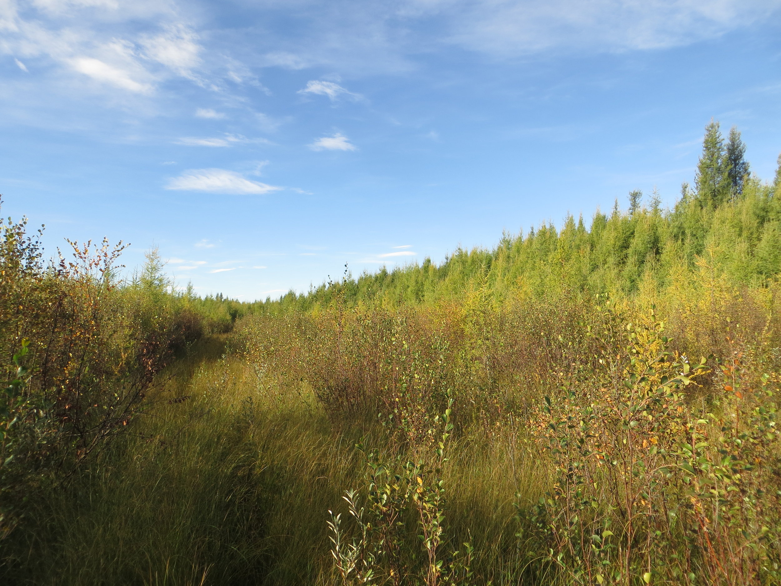
Evergreen Park in the County of Grande Prairie Alberta is home to many different types of boreal wetlands. Ducks Unlimited Canada’s remote sensing team mapped and classified some of the wetlands at Evergreen Park.
Wetland mapping at Evergreen Park using Ducks Unlimited Canada’s Enhanced Wetland Classification
Graminoid fen to shrubby fen transition

Conifer swamp

Emergent marsh to graminoid fen transition

Graminoid fen, shrubby fen, tamarack swamp
Looking to host an event, volunteer or just have questions about the Boreal Wetland Centre? Contact Us!
Stay up to date with the various events hosted at The Boreal Wetland Centre at our Event Schedule.
The Boreal Wetland Centre is a collaborative partnership. Learn more about our partners here.